
The dataset viewer is not available because its heuristics could not detect any supported data files. You can try uploading some data files, or configuring the data files location manually.
PeakWeather 🌦️🌤️⛈️
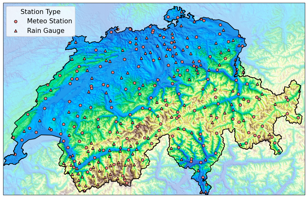
PeakWeather is a high-resolution, quality-controlled dataset of surface weather observations from 302 stations across Switzerland, collected by the Swiss Federal Office for Meteorology and Climatology (MeteoSwiss) over more than eight years. Designed to support research in spatiotemporal modeling, it includes dense time series data, topographical features, and numerical weather forecasts from an operational model at MeteoSwiss.
What's Inside
- 302 weather stations across complex Swiss topography;
- 10-minute sampling from January 1st, 2017 to October 13th, 2025 (461,952 time steps);
- 8 meteorological variables: air temperature, relative humidity, air pressure, precipitation amount, wind speed/direction, wind gust, sunshine duration;
- Topographic features from a 50m-resolution digital height model;
- Numerical weather forecasts (ICON-CH1-EPS) for benchmarking;
- Metadata for stations and variables, as well as sensor relocations information;
- Missing values and resampling utilities.
How to use PeakWeather
Use the companion GitHub library 📦 to:
- Download and cache the data locally;
- Load time series and static data into ready-to-use formats;
- Extract sliding windows of a size W and horizon H from the time series;
- Handle missing data via built-in imputation tools and (un)availability masks;
- Downsample or resample as needed for your modeling task.
For more details refer to the dataset implementation and instructions provided on GitHub.
License: CC-BY-4.0
Source: MeteoSwiss
- Downloads last month
- 38